Tom's Guide to Paris
Getting around in Paris
Whether on foot or in a bus, train, boat, or taxi, Paris is extremely easy to navigate
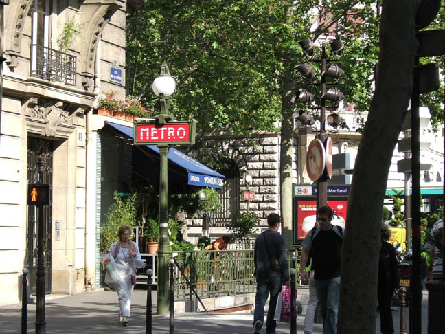
Moving about on (or with) your own two feet
First off, Paris is an unusually walkable city. It’s about 38 square miles in area, which makes it about the same land size as Miami, but unlike Miami it’s a near perffect oval, which means there aren’t lots of exaggerated distances between any two points. You like to walk? Great! You’ll be able to walk among most of the major sights in the city.
As I point out on the “Where to Stay in Paris” page, please know what you’re doing before you succumb to the urge to find a hotel near the Eiffel Tower. Aside from the tower itself, there’s not much else in the neighborhood, which is pretty sedate, and it’s rather far from the most of the other sights you’ll likely be visiting. If that’s your thing, though, fine. But if you like interesting and productive walks, consider something more towards the center of the city. Tom suggests somewhere in this area of the city, which doesn't mean you have to be smack-dab in the center (for which you'd likely pay a bit of a premium, especially in many areas of the 1st arrondissement), but wherever in this general areas seems nicest to you and to your wallet. Keep in mind that the best catches always go to the best hunters. Given that most people can walk 3 kilometers in about 35–40 minutes, the more centrally located you are the more productive your walking will be in terms of sight-seeing. In short, you’ll see things (and eat and drink things) you would otherwise never have encountered.
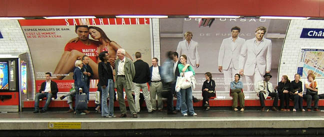
 Parisians not looking and coming right at you*
 Paris is increasingly pedestrian- (and bicycle-) friendly—some large highways have been closed to vehicular traffic and are now absolutely fantastic pedestrian havens with pop-up bars, restaurants, and coffee shops. Streets are well marked (typically on buildings at the beginning and end of a street, one story above street level, as at left), and there are pedestrian crossings all over the place. And despite the reputation of some European drivers, Parisian drives respect those crossings quite well. One thing to watch for, however, is the manner of negotiating oncoming pedestrian traffic. It's different in France than in the U.S.—for example, people won't naturally or necessarily turn to the right to avoid you. In fact, they don't seem to be paying any attention to you at all. After many years, I think I’ve figured it out. It’s kind of like basketball: each pedestrian has the ball (in their view) and you’re a defender actively getting in their way. The way to avoid this, though—and this is not like basketball—is to look 5 or 10 feet beyond the people coming in your direction. Somehow they sense that you're not taking responsibility for avoiding an accident and they’ll subtly get out of your way. I often wonder what happens to French people when they're visiting in the U.S.—I bet they get banged up a lot.
 Checking out a Vélib
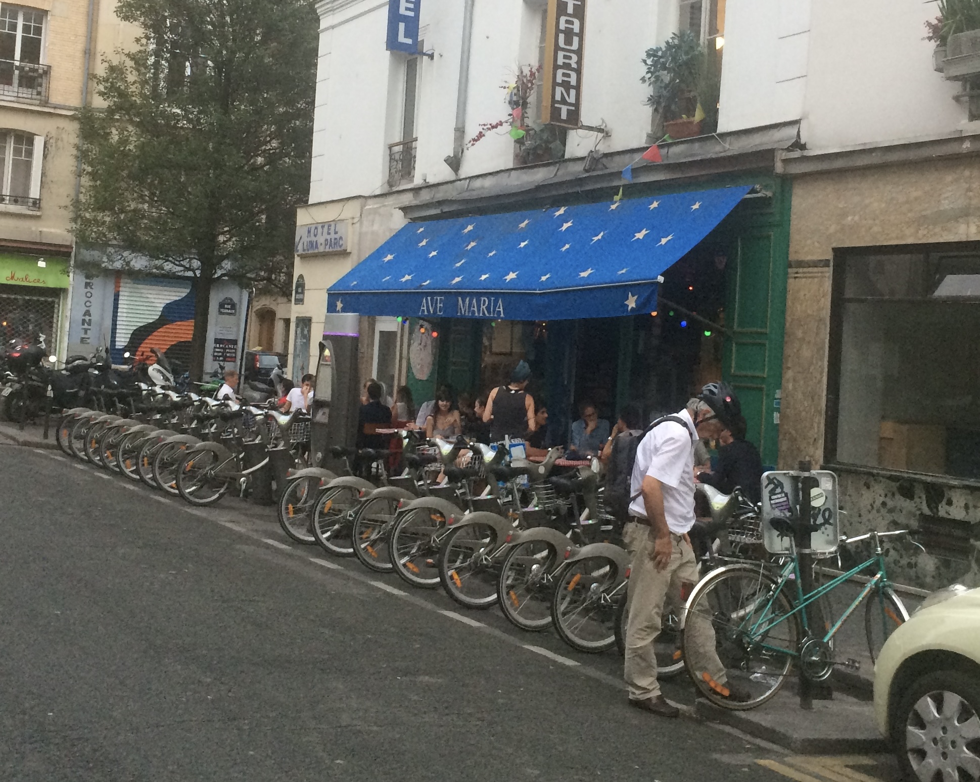
Your best other mode of self-propelled transportation is bicycling. Paris has been effecting some very significant changes to make the city more ecologically friendly, and making bicycles easily and very inexpensively available has been a very popular contribution to this goal. Vélib is the system for bicycle ride sharing. The name comes from the mix of vélo, which is another word for bicyclette; and libre, which means “free” in the sense of “liberty”; it does not mean that Vélib is free of charge. However, prices are very reasonable. The system boasts over 1400 docking stations across the city, with 19,000 bicycles available for you to hop on to and dart away. One thing, though: Parisian traffic is dense and sometimes treacherous. Helmets are not provided; you need to be extremely careful. Download the Vélib app from your favorite app store; the instructions for using the system are pretty clear. One thing that makes this so valuable is that the app will show you the docking station closest to your current location, as well as the docking station closest to your destination. You also have the choice between a standard bike (green) or a power-assisted one (blue).
Public transportation
Cabs and Ride Shares
First off: if you’re going to take a taxi from the airport, do not go with any of the guys hanging out at the airport muttering “taxi” under their breath. Go to the actual taxi stand, which is very clearly marked. (You'll find more info on taxis from the airport here.) Taking a cab or using a ride share app works exactly as you would expect it to. Despite the rumors of Parisian taxi drivers trying to rip you off, Tom has never—not even once—experienced this kind of treatment in a cab. Your Uber app will work in Paris; your Lyft app, however, currently will not. You should also seriously consider downloading the Bolt app, as well as the G7 app. Bolt is a European-based mobility company, and in Tom’s experience they’re more likely not to cancel you and to arrive more quickly than Uber. G7 is a taxi service that also functions as a ride share. One thing you should understand, though, is that with any of these apps it might take several tries and several minutes before the app matches you with a driver (although in Tom's experience, G7 is far and away the most reliable). Once the connection is made, though, it works just the way it does for you at home. How much does it cost? For 10-20 minute trips on both apps figure 15–22 euros, depending on time, traffic, and distance.
Mass transit
First things first: There are plenty of online metro and bus maps to be had, with some of the most comprehensive to be found at the Transilien site and the RATP site (with the latter easier to use in Tom's opinion). The "Bonjour–RATP" site is even friendlier, especially if you rely on your phone alot, and it's really good at plotting out directions based on your current location. You really should download that app onto your phone (and it works in both French and English). It's invaluable.
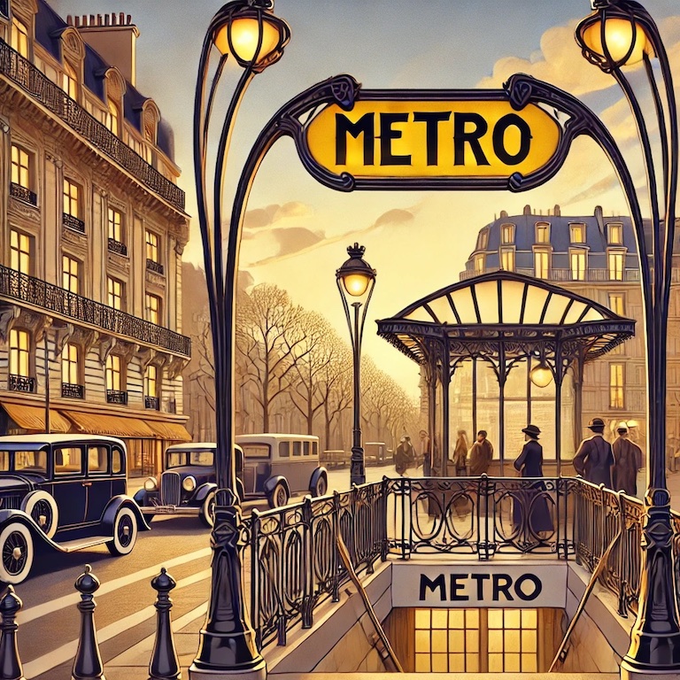
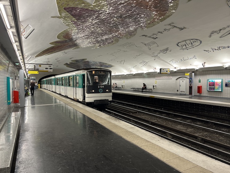
The Metro
 In Tom's view, the metro is the cheapest and most efficient means of transportatiion. It's easy to use and it'll get you anywhere. A written description of how to use the metro would appear mystifying and obtuse; once you take the thing two or three times it will be so obvious how it works that you'll just laugh at how foolish you were the first time you did it. I know: how are you going to get someplace the first time? Beats me. Try your luck. Just keep in mind that you always need to know the name of the direction you're going, not the line number alone. The name of the direction is simply the name of the last stop on the line; look at the map and follow the line to the end: there's your name. Each line thus has two names, depending on whether you're coming or going. As an exercise, check out the map at the bottom of this page. Line 4 (sort of maroon, in the north central part of the city) is called Porte de Clignancourt if you're traveling north, and Montrouge (Mairie de Montrouge) if you're traveling south (follow it to the end).
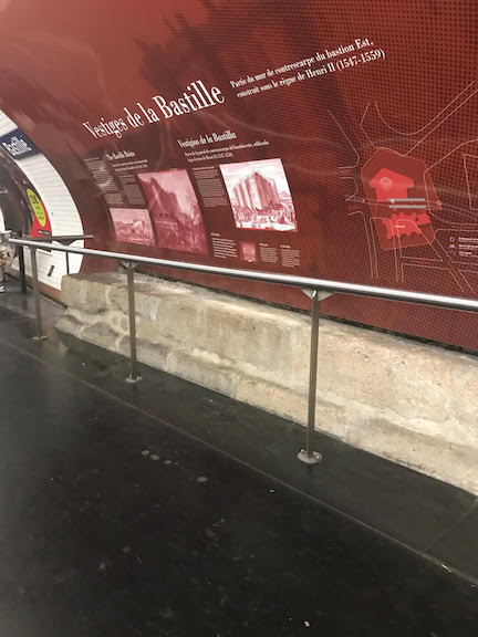 Fragments of the Bastille in the Metro
 It's crucial to know which direction you're going in. It's also necessary to know where you can transfer to another line. You can transfer between lines at stations that are marked with an open circle on the map, which is called a correspondance; on the platform where you exit your train there will be signs for the different lines available there to connect to. They are always marked with an orange banner and the word "correspondance." On that same Line 4, for example, you see correspondances at, among other places, Odéon, St-Michel, and Châtelet Les Halles, but not, for example, at St-Sulpice or Saint-Germain-des-Prés. When you take a correspondance, look for the name of the direction (last stop) on the line you're transferring to, and get on that line, exactly the way you did when you began your jourey.
 Autographs on the ceiling in the Metro (photo by Chabe01)
on the ceiling of which are large-scale replicas of the signatures of many famous people who inhabited the Latin Quarter from the medieval period forward. Some stations, especially those at older geographical sites, have archeological digs and you get to see some remnants of
Autographs on the ceiling in the Metro (photo by Chabe01)
on the ceiling of which are large-scale replicas of the signatures of many famous people who inhabited the Latin Quarter from the medieval period forward. Some stations, especially those at older geographical sites, have archeological digs and you get to see some remnants of
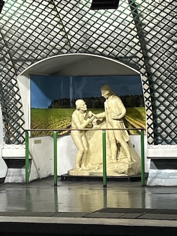 Diorama in the metro
former structures or other such things. Here you see the remainder of part of the original foundation of the Bastille before it was stormed during the Revolution in 1789 (cool, huh?).
Diorama in the metro
former structures or other such things. Here you see the remainder of part of the original foundation of the Bastille before it was stormed during the Revolution in 1789 (cool, huh?).
The newer lines, and those that have been renovated, are nearly completely automated, some without drivers. They have these transparent walls on the platforms to prevent people from falling onto the tracks, and when the trains arrive at the station the doors open automatically. In some of the driverless trains you can stand at the very head of the train, where the drivers are in the manually operated trains, and watch as the train flies forward. Sometimes you have to urge little kids to move out of the way to do this, but it’s really fun.
| OK, because people have been asking and because you can't seem to take any initiative, here's a brief lesson on how to take the metro. |
The Bus System
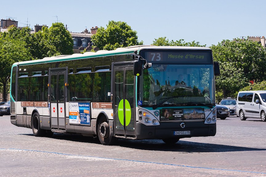 Paris bus, by PR180.2
If you’re feeling brave and adventurous, try to figure out the bus system; while it might take you a little longer than other forms of transportation, the advantage of seeing things and getting a better sense of where you are is unmistakable. It’s not that hard to figure out, but sometimes you go places you hadn’t planned on going, which, I guess, isn’t so bad. Your metro pass will work on the busses as well—you can ride pretty much as far as you want within the city of Paris. If you know where you're going, the "Bonjour–RATP" app will show you several options for your trajectory, including metro, bus, and even walking. This is a good way to start to get a feel for where the busses go (and now Tom realizes there's no way to write the plural of "bus" without its looking weird; buses?). Every bus stop has a map showing the entire route; and many stops have a digital indicator telling you how long you have to wait for your ride. There are also indicators inside the bus that alert you to the upcoming stops. When your stop is coming up—i.e., when it's the next one—push the red button marked "Arrêt" afixed to many of the upright poles in the bus.
Paris bus, by PR180.2
If you’re feeling brave and adventurous, try to figure out the bus system; while it might take you a little longer than other forms of transportation, the advantage of seeing things and getting a better sense of where you are is unmistakable. It’s not that hard to figure out, but sometimes you go places you hadn’t planned on going, which, I guess, isn’t so bad. Your metro pass will work on the busses as well—you can ride pretty much as far as you want within the city of Paris. If you know where you're going, the "Bonjour–RATP" app will show you several options for your trajectory, including metro, bus, and even walking. This is a good way to start to get a feel for where the busses go (and now Tom realizes there's no way to write the plural of "bus" without its looking weird; buses?). Every bus stop has a map showing the entire route; and many stops have a digital indicator telling you how long you have to wait for your ride. There are also indicators inside the bus that alert you to the upcoming stops. When your stop is coming up—i.e., when it's the next one—push the red button marked "Arrêt" afixed to many of the upright poles in the bus.
You can also use the city buses to do a sight-seeing tour of the city, almost every bit as good as the expensive private ones, for the cost of one bus/metro trip. On top of that, you'll get to do some really good people watching as you observe native Parisians in their quotidien activities (and perhaps catch some good gossip). Just try not to do this at rush hour. Here are Tom's favorite tourist bus rides:
Make sure you look at the arrows on the map at your starting-off point to get on the bus going in the right
direction (check to see if the stops on the route you want to take are located in the direction the arrow on the map is pointing).
Bus 69: Board at Champ de Mars. See the Eiffel Tower, Invalides, Musée d'Orsay, Louvre, Hôtel de Ville, Bastille. Get off there and enjoy the cafés, bars, and restaurants in and around the Bastille.
Bus 72. Board at Pont de Bir-Hakeim or Pont d'Iéna. See the Eiffel Tower, Grand Palais, Concorde, Tuileries, Louvre, Pont des Arts, Châtelet, Hôtel de Ville, Sully Morland. Get off here to visit the Ile Saint Louis or continue all the way to the Gare de Lyon.
Bus 63. Get on at Trocadéro. See Eiffel Tower, Invalides, the Saint-Germain neighborhood, Cluny, Dante, Collège de France and other areas of the Latin Quarter (5th arrondissement), Institut du Monde Arabe. Get off at Saint-Germain–Cardinal Lemoine.
Study the expanded bus route map at Bonjour-RATP and invent your own trip.
Paying your way
The previous byzantine system of paying for transportation (and proving that you did) was completely replaced on January 1, 2025. A new feature of Paris transportation is that what used to be a complex system of zones is now
 simplified: your trip costs the same pretty much no matter where you're going. Single tickets don't exist anymore (which is great, because there's a ton less litter now), and you can purchase a credit-card sized pass onto which you can load different fare options. You can also just load everything onto your phone.
Tom suggests you consider a version of the Navigo Pass. You can also load your payment onto your phone so you only need to wave your phone at the validation points in the metro or on the bus and then go your merry way. Get yourself the "Bonjour RATP" app for your phone, and follow the instructions there or check out
 what our friends at
Reddit have built to guide you through the process of paying with your phone here. The app is also great for showing you the best (and alternative) routes to get wherever you want to go, and it will also tell you if there are problems on any of the train or bus
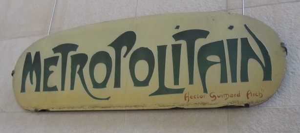
lines; it will also tell you how long before you bus arrives. Oh, and by the way: the "Métropolitain" design you see here—and which you'll still see around town in some places—was originally created by Hector Guimard in 1900. The one you see here is hanging in the Musée d'Orsay.
what our friends at
Reddit have built to guide you through the process of paying with your phone here. The app is also great for showing you the best (and alternative) routes to get wherever you want to go, and it will also tell you if there are problems on any of the train or bus
lines; it will also tell you how long before you bus arrives. Oh, and by the way: the "Métropolitain" design you see here—and which you'll still see around town in some places—was originally created by Hector Guimard in 1900. The one you see here is hanging in the Musée d'Orsay.
Proof of purchase
Metros and busses are patrolled by people in smart blue uniforms called controleurs (control freaks?) who will ask to see your proof of payment. They have these scanning devices that they aim at your pass, and they can tell if you have paid for the right to travel. If you do not, they can fine you and humiliate you and just make things in general unpleasant for you. If you are caught in a situation such as this, you're in what's called a SITUATION IRREGULIERE, and it's as scary as it sounds. They can demand a 70 euro fine on the spot (yes, they accept credit cards). If you choose to contest it, the fine can go up to 120 euros.
The metro closes at about 1:15 am (or 2:15 on weekends and before holidays)—and this varies, so don't push your luck—and doesn't open again until about 5:30 am. (And here's a cool thing: you'll know if you made the last metro if you note as the train pulls into the station that the two lights placed above the windshield on the front of the train are flashing slowly [as opposed to being just on]. I’m not sure the value of this, except you can feel all, "whew! we made it!" when you do.
The bus system isn't that hard to figure out, but sometimes you go places you hadn’t planned on goingIf you're going to be out after this (and you will be) then you must do one of several things: stay in your neighborhood, walk, take a cab or an Uber (which works somewhat well here), a G7, a Bolt, or venture into the exciting world of the night buses. I, of course, am all for the exciting world of the night buses—Noctilien. The night busses travel a different schedule from the day busses; they come slightly less frequently (although on weekends it's something like every ten minutes), and they cover slightly less ground, so unless you happen to be staying right on the night bus's route, you'll probably have to walk a bit when
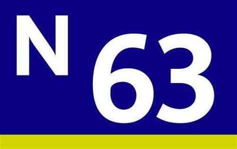 you get off, but so what? Here's a lot of official information in English on the Noctilien. You can recognize where the night buses stop by this helpful little "N" and by the lovely dark blue color scheme.
If you have a passe navigo (monthly or weekly) this is all you need. Some of the people on the night bus all look angry and mean, and some of them are; some are simply tired after a long day's work. If you just mind your own business, however, you'll really be fine—people have other things on their mind than worrying about your cheap self.
you get off, but so what? Here's a lot of official information in English on the Noctilien. You can recognize where the night buses stop by this helpful little "N" and by the lovely dark blue color scheme.
If you have a passe navigo (monthly or weekly) this is all you need. Some of the people on the night bus all look angry and mean, and some of them are; some are simply tired after a long day's work. If you just mind your own business, however, you'll really be fine—people have other things on their mind than worrying about your cheap self.
Check out Bob Reynolds' amazing Subway Page for insanely interesting info on public transportation the world round.
Getting your sea legs
Sandy highly recommends the Batobus, a boat (bateau, pronounced "bato" + bus—get it?) that takes you up and down the Seine, stopping at nine locations. You can buy a pass good for 1, 2, or 365 days (at an intriguing pricing of 23, 27, 73 euros, respectively). Tom hasn't spent much time on water transportation in Paris, so he doesn't feel he can comment, but why in the world would Sandy lie?
Metro Map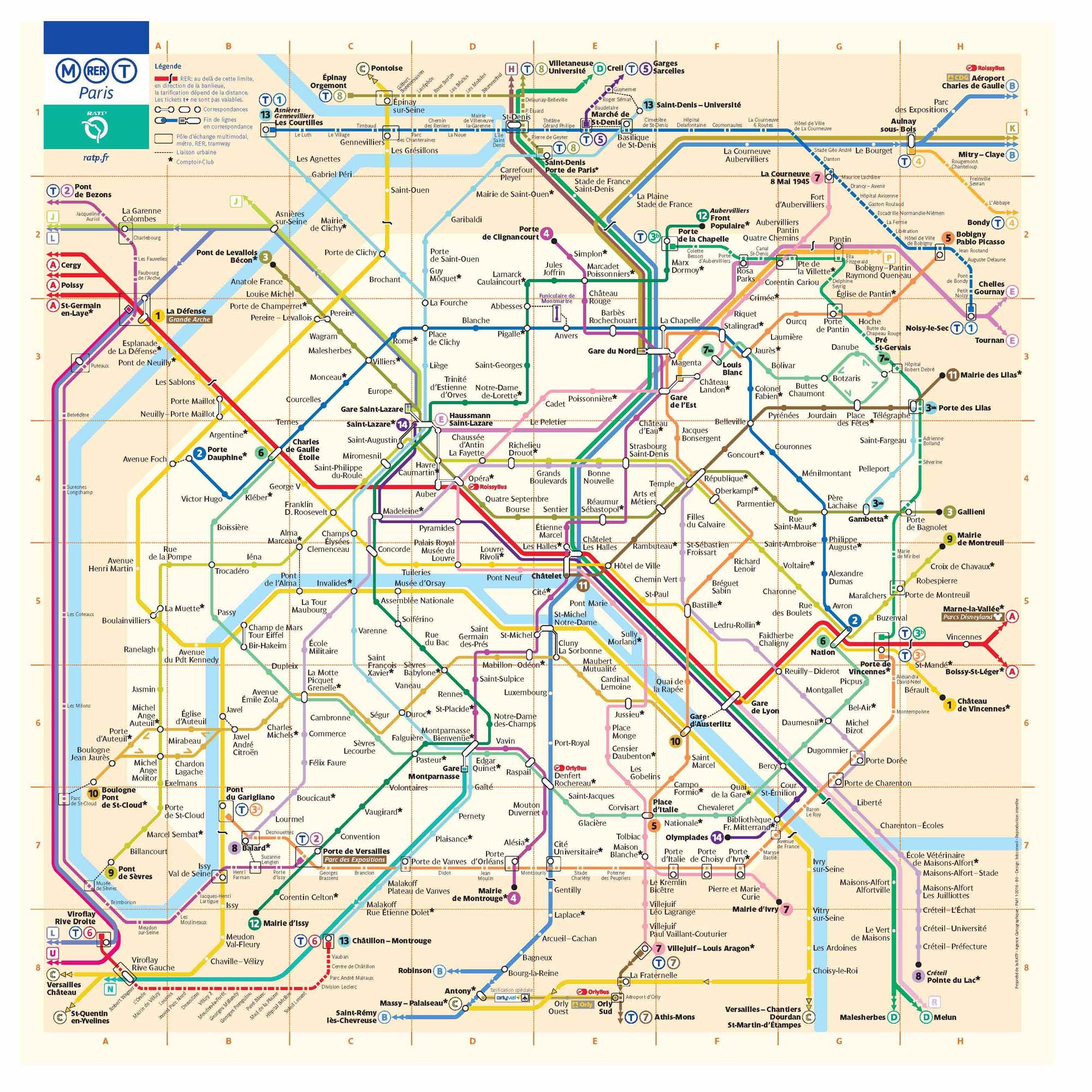
*Gustave Caillebotte. "Paris Street, Rainy Day" (1877), Art Institute of Chicago